
The study area of the French Archaeological Mission in Artigas (north-west Uruguay) is the micro-basin of the arroyo Catalán Chico, a river that flows through the department of Artigas and belongs to the Río de la Plata hydrographic basin. This area has been the scenario of episodic archaeological investigations since the 1950s, initiated by Antonio Taddei (1908-1995), a precursor of scientific archaeology in Uruguay. A. Taddei discovered various surface sites that attracted the attention of the American archaeological community for several decades.
His typological and cultural-historical definition of the Catalanense lithic industry was a kind of guiding fossil in the discussion on the first settlements of the southern cone of South America, an industry supposed to be the archaeological representative of human populations from around 10,000 BP.
It was not until the late 1990s that new investigations defined a regional archaeology comprising over a hundred surface sites (beyond the Catalán area), enabling the Catalanense to be rethought on the basis of a petrographic characterisation of the raw materials used and an understanding of the reduction sequence of lithic artefacts. Despite the fruits of the applied geoarchaeological approach, the archaeology of the Catalán Chico arroyo still lacks 1- a robust chrono-stratigraphic column, 2- a homogeneous understanding of the functionality of the sites (all presumed to be workshop quarries), 3- a territorial understanding of the cultural identities expressed archaeologically. For these reasons, there was an urgent need for archaeological work to be carried out that would take the results of earlier research and extend them by carrying out exhaustive analyses of the material culture based on its internal variability. This is the purpose of the Mission Archéologique Française d’Artigas.
The mission’s contemporary scientific focus is on a classic archaeological locality in South America, with the aim of assessing its stratigraphic potential, carrying out radiometric dating and recovering archaeological material from contexts undisturbed by post-depositional alteration.
This first year of excavations and surveys (July-September 2021) has revealed a succession of human occupations, clearly identifiable within the stratigraphy. Specific lithic industries characteristic of the region have been uncovered and will be monitored by OSL and 14C dating (measurements in progress).
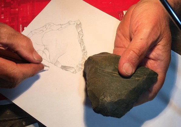
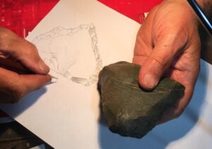
Figure 1: End-of-day activity: functional graphic representation of a green arenite tool showing the 3 functions typical of Catalan industries.
The explorations, carried out in parallel on the basis of geomorphological similarities, identified several potential areas for new stratigraphy. The presence of lithic industries at sub-surface level has enabled us to confirm our analysis of the terrain.
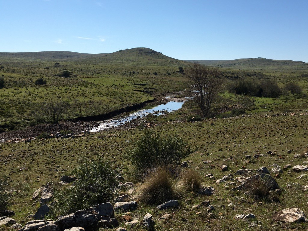
Figure 2: The landscape can be ‘read’ to define potential areas for archaeological sites: find outcrops of raw materials, imagine the past course of the river, the location of dry and healthy areas where settlement seems possible.
The year 2022 will be the year of in-depth investigation of the potential zones we have just revealed.
Coordinator France: Hatté C. – coordinator Uruguay: Gluchy M.
Financing 2021-2024: Ministry of Europe and Foreign Affairs.