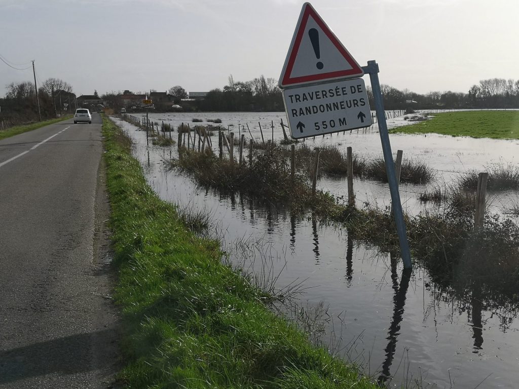
February 2026 – Four days in the mudflats of the Loire estuary with the OCEANIS team, despite very unfavorable weather conditions and historic flooding.
The twin crises of climate change and biodiversity loss represent two of the most significant challenges facing humanity in the 21st century. Intertidal sedimentary ecosystems, which cover more than 10,000 km² of the European coastline, provide essential ecosystem services and benefits such as carbon sequestration, climate change adaptation, and biodiversity support. However, these habitats face increasing threats from fragmentation, resource depletion, and sea level rise.
This four-day campaign in the Loire estuary is part of Bocar Konte’s thesis and the European REWRITE program (REWilding and Restoration of Intertidal Sediment Ecosystems for Carbon Sequestration, Climate Adaptation and Biodiversity Support) program, which aims to strengthen the ecological and societal resilience of these vital ecosystems through innovative approaches to renaturation and restoration.
Among these ecosystems, intertidal mudflats are characterized by high gross primary production dominated by micro-phytobenthos. This specificity would allow remote sensing quantification of locally produced carbon stocks. These areas undergo rapid physical, chemical, and biological changes due to tidal cycles, weather conditions, and human activities. These processes can displace and transform the carbon fixed by micro-phytobenthos. It is therefore essential to understand the high-frequency dynamics of these interfaces in order to predict the evolution of mudflat biogeochemical cycles in the context of climate change, as well as their capacity to sequester carbon.
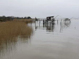
This first campaign, which took place from February 16 to 19, 2026, in the Corsept mudflat (France – 44), aimed to begin exploring the high-frequency biogeochemical dynamics of intertidal mudflat interfaces with a view to ultimately developing a robust model for predicting early diagenesis processes in response to climate change scenarios or site renaturalization (e.g., removal of coastal protection dikes).
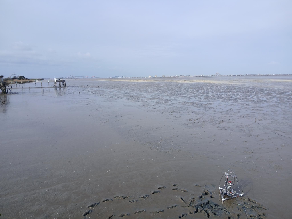
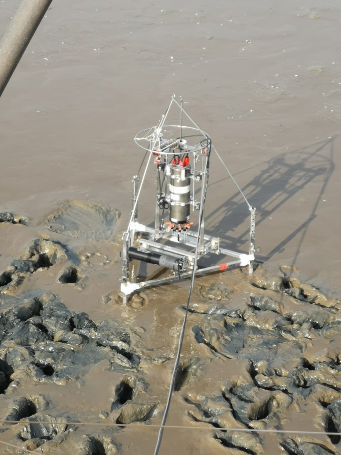
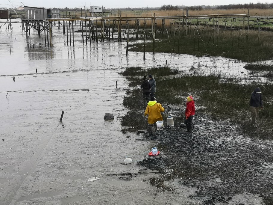
Despite very unfavorable weather conditions and historic flooding of the Loire River, the OCEANIS team successfully deployed a benthic station equipped with an in situ microprofiler over one tidal cycle and recovered seven series of vertical oxygen profiles (z) across the water-sediment interface: three series of flow dynamics profiles and four series of ebb dynamics profiles. The physicochemical characteristics of the tidal cycle were also documented using an NKE Wimo CTD and a Diver CTD attached to the station. Finally, a core sample was taken to recover interstitial fluids from 30 cm of the sediment column in order to measure the concentrations of (1) dissolved inorganic carbon (as well as its isotopic composition), (2) dissolved methane, (3) nitrate, and (4) sulfate. Similarly, hourly water samples were taken from the flow dynamics to measure the same chemical parameters.
At the same time, the LPG team from the University of Angers took sediment cores for a high-resolution vertical study of concentration gradients at the water-sediment interface. For its part, the ISOMER team at the University of Nantes took samples to quantify micro-phytobenthos and measured CO2 flux at the sediment-air interface.
The next mission on the Loire estuary will take place in April. The OCEANIS team will use its brand new UNISENSE benthic station, which allows for longitudinal (x) exploration of water-sediment or air-sediment interfaces and complete autonomy in the mudflats for several weeks.