
Presentation
The LSCE’s OCEANIS team is part of the movement to develop high-frequency observation stations for the coastal environment and has set up a sediment observatory: a benthic station equipped with a benthic profiler.
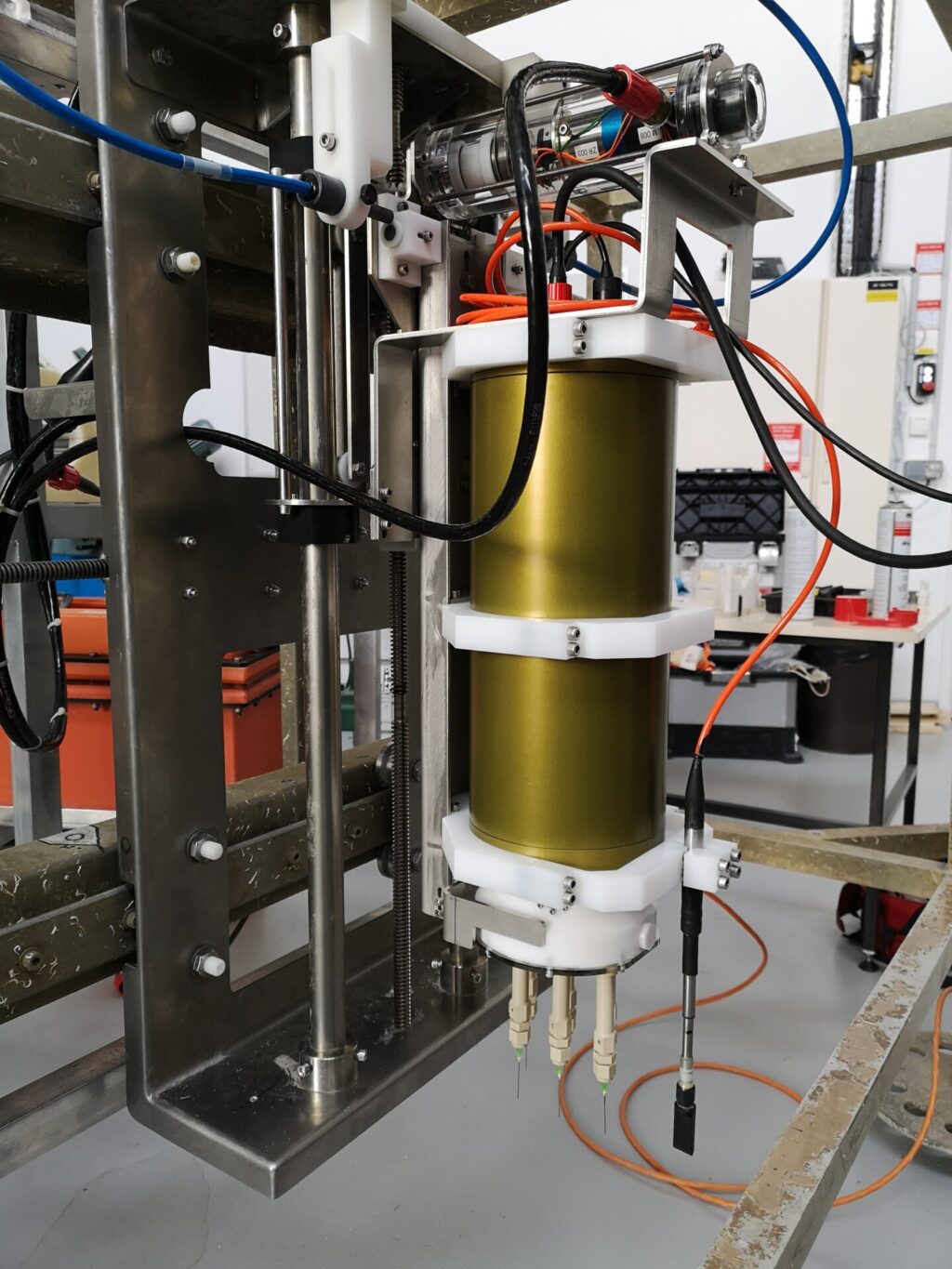
This autonomous in situ benthic station was developed in 2008 in partnership with the Technical Division (TD) of INSU-Meudon. The profiler, also developed by the TD, uses Clark-type glass microelectrodes to measure the vertical distribution of oxygen at a vertical resolution of 200 μm at the water-sediment interface. However, the relative lack of success in the past, due to the fragility of the sensors during very energetic events such as certain floods, prompted us to consider changing the measurement system and switching to micro-optodes. These sensors are optical fibres with a pointed end (50 µm) coated with a Ruthenium(II) complex that uses fluorescence to show the presence or abscence of oxygen.
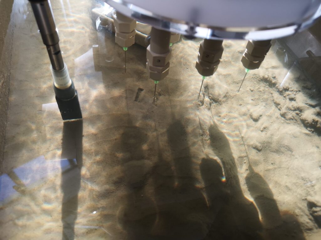
The lateral displacement of the profiler, over a distance of 1.5 m and in 12 cm increments, provides access to the variability and spatial heterogeneity of the sediment. This station is deployed near the mouth of the Rhône river at a depth of 20 m, for immersion periods of two to three months, and is thus able to carry out spatio-temporal series of oxygen micro-distribution (a proxy for carbon recycling).
In “low frequency” mode, the benthic station carries out a daily profile, but in the event of flooding of the Rhône or storms (increase in turbidity), the station switches to “high frequency” mode and can carry out four profiles a day. This makes it possible to monitor the start of the event, the event itself and the return to normal, and to study the biogeochemical response to extreme events such as floods or storms.
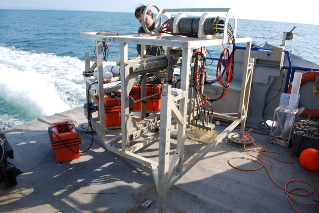
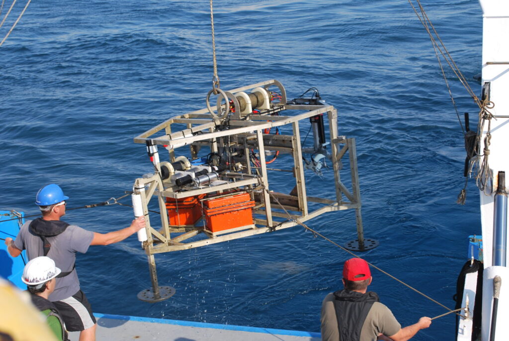
The Benthic Station consists of an aluminium frame of 1.9 m long, 2.0 m wide and 1.3 m high, weighing 350 kg in air and 170 kg in water. The profiler is fitted with 6 micro-optodes that enable oxygen profiles to be taken at the water-sediment interface. The environmental sensors (NKE WIMO probe), installed on the Station and connected to the central unit, continuously analyse the physiochemical parameters of the bottom water (temperature, salinity, turbidity, dissolved oxygen concentrations). The benthic station sends its data directly to the LSCE via the Roustan Est buoy (43°19.036′ N / 4°51.964′ E), which marks the Mesurho station in the Rhône prodelta, at 20 m depth.
As part of the RiOMar programme, the benthic station is one of the key elements in the study of the ‘Rhône’ section, where flooding accounts for more than 70% of the annual input of particulate matter (Pont et al., 2002), where the recirculation and transport of carbon towards the shelf occurs via resuspension and where the coupling between the benthic and pelagic compartments is very close.
In addition, the experience acquired during the years of development is being put to good use in the development of LSCE’s benthic profiler (bathy-Prof), which will be installed in the coming months on the BathyBot robot deployed in 2022 at a depth of 2,500 m, 40 km from Toulon. Thanks to its mobility, sensors, analysers and cameras, this tracked robot opens the way to adaptive monitoring strategies, enabling the acquisition of observations in real time and over the long term, around strategic points in the deep marine environment.
Building on the two experiments mentioned above, the LSCE and the TD INSU have proposed, as part of the DeepSea’Nnovation project, the design of a new-generation autonomous profiler that can be deployed in the deep ocean using an ROV. Finally, the feedback from these two projects (DeepSea’Nnovation and Bathy-Prof) will enable us to picture a complete overhaul of the benthic station in the near future.