
Presentation
In addition to its main mission for greenhouse gas (GHG) mole fractions monitoring through the SNO, the ICOS-RAMCES team began studying the GHG composition of the total atmospheric column using remote sensing in 2018 with the following objectives:
- Long-term vertical monitoring of GHGs
- Cal/val mission of satellite measurements (OCO-2, OCO-3, microcarb, MERLIN etc.)
- Validation of atmospheric models
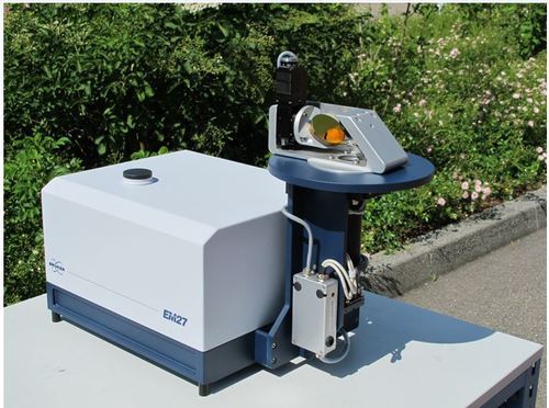
These measurements are carried out using Fourier transform infrared spectrometry with the EM27/SUN portable instruments (Bruker). These passive instruments use direct solar radiation as their light source. The spectra acquired can be used to determine the total amount of CO2, CH4, CO and H2O contained in the entire atmospheric column. A solar tracker attached to the instrument directs solar radiation into the spectrometer.
Instrument features:
- Interferometer: RockSolid
- Resolution: 0.5cm-1
- Spectral range: 4000 – 15000 cm-1
- Detectors: InGaAs diode
- Acquisition frequency: 1 minute
Spectra are processed by PROFFAST software (developed and maintained by KIT in Germany), and an automatic processing chain developed at LSCE provides total column results in near-real time.
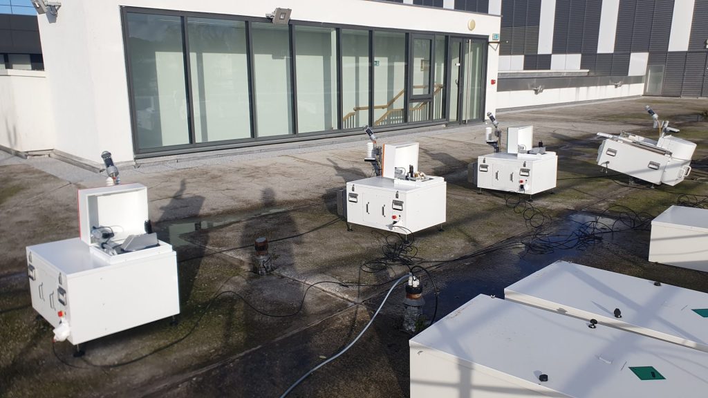
Automated spectrometer enclosure system (ASES):
With the aim of building a robust total column measurement network, the ICOS-RAMCES team has developed a self-contained, watertight enclosure system to accommodate the EM27/SUN and protect it from external conditions. When sunlight conditions are met and there is no precipitation, the system opens and measurements start automatically.
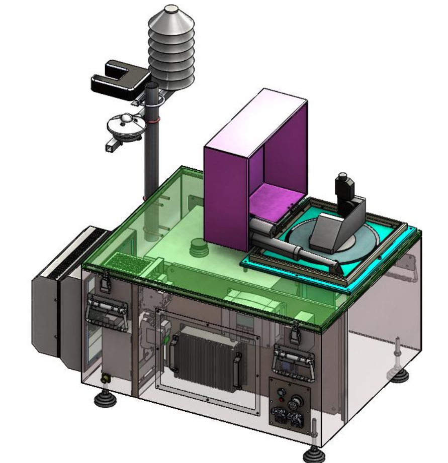
ASES features:
- Luminous flux acquisition: solar radiation sensor to measure light intensity
- Precipitation detection: precipitation sensor to record rain and snow data
- Acquisition of meteorological parameters: system for measuring atmospheric pressure, temperature and relative humidity
- Acquisition of internal parameters: monitoring of temperature and relative humidity inside the system
- Communication: connectivity via 4G, wifi, Ethernet and GPS for reliable data transmission, time synchronization and instrument geolocation
- Control and management: use of a PLC to manage system operations and sensors
- Back-up power supply: UPS system to ensure continuous power supply in the event of a power failure
- Thermoregulation: thermal control system to maintain optimum operating conditions